
Glendora ZIP Code Coverage
Los Angeles County's official master ZIP directory identifies two ZIP codes that serve Glendora geography. For Glendora readers, the coverage lines are more useful than a city-name guess because postal names and city limits do not always match. The post-office column below points to the USPS verification route rather than inventing a station name that the Glendora research did not establish.
| ZIP Code | Areas Covered | Post Office | Notes |
|---|---|---|---|
| 91740 | Southern and central Glendora; unincorporated Glendora | USPS address lookup | Postal name does not prove city jurisdiction |
| 91741 | Northern and foothill Glendora; part of San Dimas; Angeles National Forest | USPS address lookup | ZIP and city lines differ |
That is the core of the Glendora postal map. ZIP 91740 can include unincorporated Glendora, while ZIP 91741 reaches beyond Glendora into San Dimas and the national forest. For a Glendora address, a full address must be checked before a ZIP result is connected to a resident or parcel.
ZIP Code 91740 in Glendora
ZIP 91740 covers southern and central Glendora as well as unincorporated Glendora. In Glendora, the postal label can therefore bring together addresses that do not share the same city jurisdiction. A ZIP search that stops at “Glendora” may blur that distinction.
Use the ZIP as a delivery clue, then verify the complete address through USPS address lookup. Next, use the Los Angeles County Assessor Portal for a Glendora AIN or situs address and the city GIS layer for the parcel and Glendora jurisdiction context. The assessor does not offer a ZIP-wide browse of residents.
For a Glendora family or archive search, keep the ZIP in the citation but search the directory by name and address. The ZIP can help distinguish two similarly named streets, yet the historical volume remains the dated source for a listed household.
Glendora ZIP Code 91741 Crosses Local Lines
ZIP 91741 covers northern and foothill Glendora, part of San Dimas, and Angeles National Forest. This is the most important Glendora geography warning in the postal map. A 91741 address can carry a Glendora postal label while the relevant city, parcel, or public office context is different.
Confirm the ZIP with USPS, then confirm city jurisdiction in the Glendora GIS entry page or the relevant map layer. The ZIP does not decide whether a permit belongs to Glendora, San Dimas, or an unincorporated area. It also does not determine which historical Glendora directory volume used the address.
Note: ZIP 91741 is a delivery boundary with a wider footprint than incorporated Glendora, so the Glendora postal label needs a second check.
Verify a Glendora ZIP Code With USPS
The USPS lookup is the authoritative address-to-ZIP check captured in the Glendora research. Enter the complete street, city, and state information, then compare the returned ZIP Code with the one in the Glendora record or letter. The lookup confirms delivery geography. It does not verify ownership, occupancy, a permit, or city jurisdiction.
| Full address | Text address route; use the complete street, city, and state information |
|---|---|
| ZIP result | USPS returns the delivery ZIP for the entered address |
| Jurisdiction check | Use city GIS or the responsible agency after the ZIP result |
The USPS address lookup is a verification step inside the Glendora postal directory, not a replacement for the Glendora parcel or resident systems.
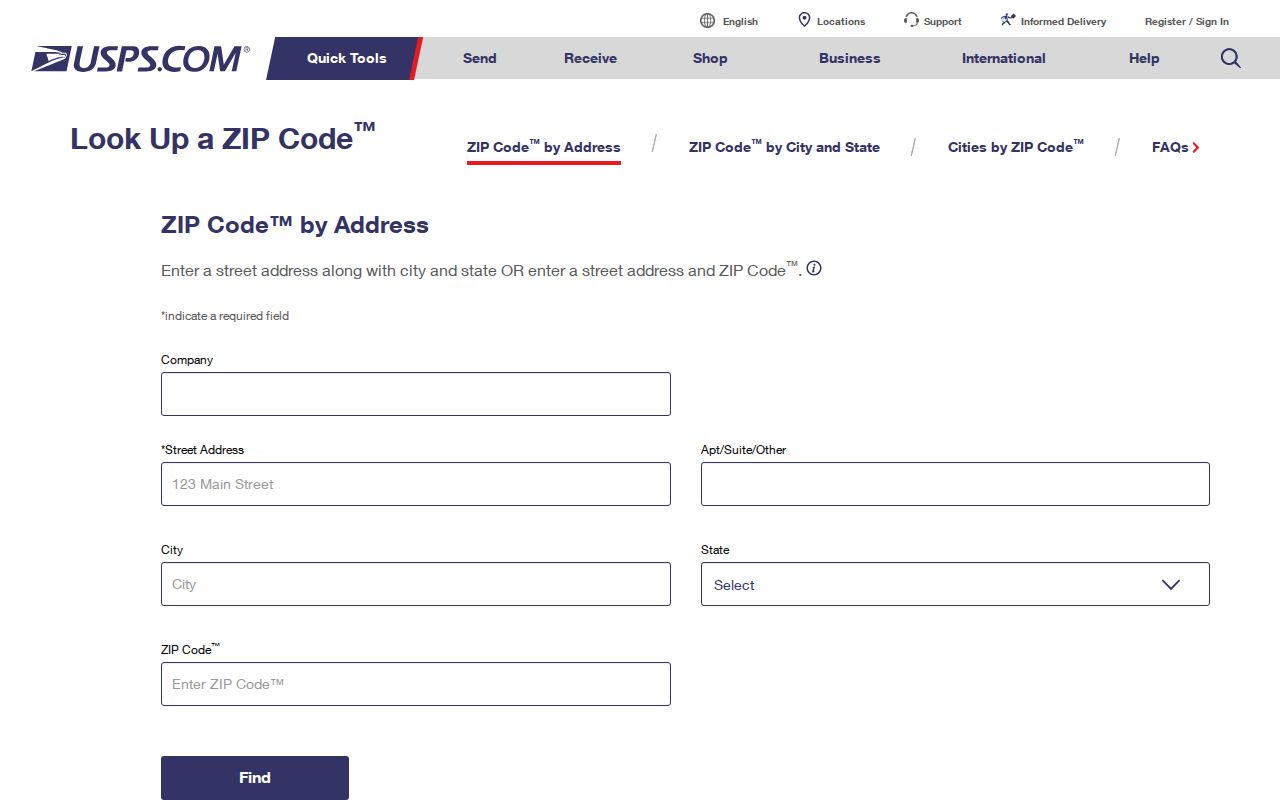
The USPS image belongs before any Glendora parcel or person conclusion because the delivery result is the first boundary check.
Narrowing Glendora Residents by ZIP Code
A ZIP does not unlock a public list of Glendora residents. Use it to narrow a known Glendora address or to sort a lawful record request, then move into the source that has the needed field. The assessor accepts AIN or address, the voter status tool accepts last name, birthdate, house number, and ZIP Code for an individual, the recorder has no public web index, and the Community Archive searches names and places in historical scans.
- Verify the full address and ZIP through USPS.
- Use the assessor portal to preserve the AIN and situs facts.
- For your own registration, use the California or LA County voter-status tool.
- For past households, search the archive by surname, address, and date.
- Once a ZIP narrows to a street, use the Glendora By Street page for parcel-by-parcel work.
The workflow keeps “Glendora residents by ZIP” as a search phrase rather than a promise of a ZIP-wide roster. It also makes the source and access limit visible at every Glendora handoff.
Glendora ZIP Code Filters That Do Not Exist
The Glendora research did not verify an assessor ZIP-wide browse, a recorder ZIP index, or a voter street browse that can be used without the state's lawful request rules. The Assessor Portal documents AIN and address search, not a ZIP-coded resident directory. The recorder indexes person or entity name and recording year, not address, AIN, or ZIP. The California voter-status tool is an authenticated personal check.
When a Glendora portal lacks a ZIP filter, do not fill the gap with a commercial compilation. Build a defined list from verified addresses, then evaluate each parcel or record under its own access rules. A California voter-file order may contain address and ZIP fields, but it requires an application, contract, lawful purpose, and cited fees.
That absence is useful information. It tells a researcher when the Glendora ZIP search should hand the question to a street workflow, a records request, or an archive search.
Glendora Situs, Mailing, and ZIP Code Geography
Three maps can overlap without answering the same question. Situs is where the Glendora parcel sits. Mailing is where correspondence goes. The legal description is the title geography. ZIP Code is the delivery geography. AIN is the county key. A Glendora postal directory should name each layer instead of treating “Glendora” in a mailing line as proof of incorporated-city location.
- ZIP Code
- A delivery area used by USPS, not a parcel or municipal boundary.
- ZIP+4
- An extended delivery code that narrows a mailing route beyond the five-digit ZIP.
- PO-box ZIP
- A ZIP assigned to post-office boxes or a postal facility, not a map of households.
- Unique ZIP
- A ZIP assigned to one institution or organization when USPS designates one; none was identified in the local research.
- Carrier route
- A delivery route inside the postal system, not a city planning district.
The Glendora research did not locate a verified local ZIP split history, grid baseline, E911 assignment statement, or AIN digit interpretation. For an uncertain Glendora address, keep the USPS result, GIS result, and assessor result side by side.
AIN Is Glendora's ZIP Code Parcel Bridge
The AIN is the best bridge from Glendora ZIP geography to a particular parcel. The Los Angeles County Assessor Portal accepts a ten-digit AIN or situs address and provides mapped parcel discovery, legal-search mode, and basic parcel facts. The public sample exposed AIN, use type, parcel type, tax-rate area, status, land area, map links, and roll values. It did not expose an owner name or mailing address on the inspected public card.
Save the AIN before moving to deeds, permits, tax history, or Glendora neighbor parcels. The AIN can keep two addresses with similar names from being merged. It does not create a ZIP-wide list and it does not prove who occupies the parcel.
The sample Los Angeles County assessor parcel shows the parcel fields that can follow a ZIP clue.
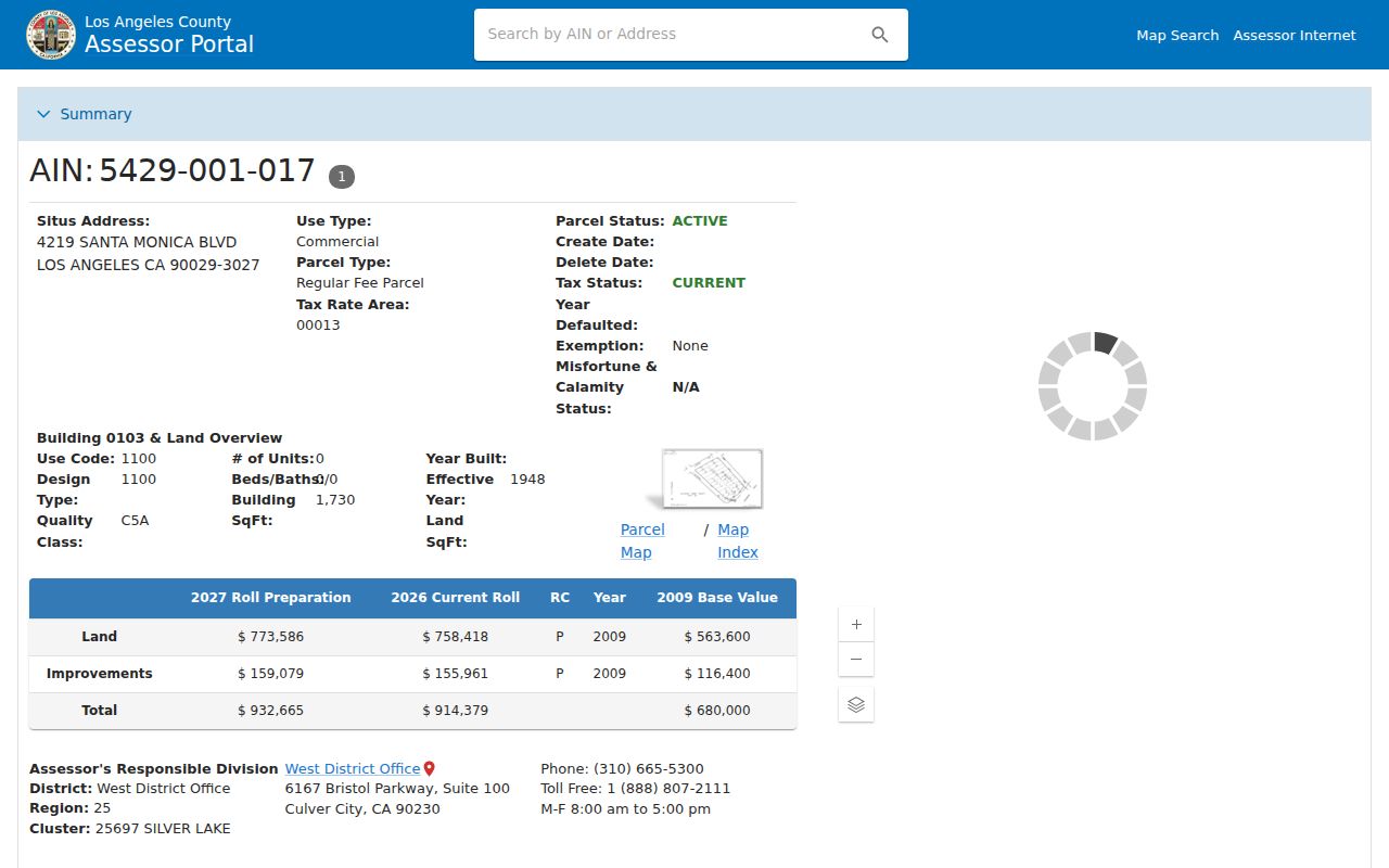
The sample parcel image shows the kind of physical record that turns a Glendora ZIP clue into a tractable parcel question.
Glendora ZIP Code Clues by Custodian
Each office receives a ZIP clue in a different form. USPS verifies the full mailing address. The assessor converts an address into an AIN and parcel record. Glendora GIS shows Glendora map context. California My Voter Status uses ZIP only as one of four matching fields for a personal registration check. A voter-file request can carry ZIP and address fields, but it requires the state's contract and lawful-purpose rules. The recorder does not accept ZIP as an online index key at all.
Historical work takes a different route. The Community Archive searches names, places, titles, and date ranges in OCR and page scans, so a ZIP is usually a supporting clue rather than the search key. A city document, permit, or CPRA request must go to the agency that holds the identifiable record. This custodian map keeps the Glendora ZIP code directory grounded in real Glendora access channels: USPS for delivery, county systems for parcels, state systems for personal status, and local archives for dated households.
Note: When a portal has no ZIP filter, narrow the known address first and keep the ZIP as a verification field.
ZIP Code Directory Limits in Glendora
A Glendora ZIP directory cannot show every person receiving mail, every household member, or every protected resident. Utilities, deliveries, DMV addresses, and Safe at Home participants remain outside an ordinary public ZIP search. The ZIP also cannot settle whether an address is inside incorporated Glendora or a neighboring jurisdiction.
Use the right Glendora layer. Verify delivery with USPS, jurisdiction with GIS, parcel identity with the assessor, and a person's own registration through the official voter-status route. Do not use a ZIP or address to stalk, harass, or harm anyone.
For a former Glendora household, the city directory collection and deed chain provide the historical route. For a Glendora block, use the parcel-by-parcel neighbor method. For a single resident, shift to the resident lookup page and preserve the source fields that support any conclusion.